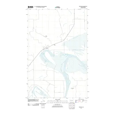
2011 Map of Trenton
USGS Topo · Published 2011About this map
The Missouri River defines the landscape of this region, its wide channel and braided sandbars carving through the southwestern corner of Williams County. The community of Trenton sits just north of the river, positioned near the crescent-shaped Lake Trenton, an oxbow feature that indicates the river's historic shifts across the floodplain. The surrounding terrain is marked by deep drainage features including Miller Coulee and Bobs Coulee, which lead down toward the river valley.
Find a feature on this map
24 named features on this map. Tap any name to fly to it.
Don’t see what you’re looking for? This feature index may not catch every label — zoom into the map to look around manually.
Map Details
Editions of this 2011 Trenton Map
This is the sole edition of this map. No revisions or reprints were ever made.
Other maps of this area

1953 · Williston
USGS Topo · 1:250,000

1953 · Watford City
USGS Topo · 1:250,000

1957 · Williston
USGS Topo · 1:250,000

1957 · Watford City
USGS Topo · 1:250,000

1959 · Williston West
USGS Topo · 1:24,000

1967 · Watford City
USGS Topo · 1:250,000

1968 · Trenton SW
USGS Topo · 1:24,000
1968 · Buford
USGS Topo · 1:24,000

1969 · Trenton
USGS Topo · 1:24,000

1969 · Cartwright NE
USGS Topo · 1:24,000