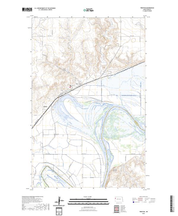
2024 Map of Trenton
USGS Topo · Published 2024About this map
Trenton sits at a significant bend in the Missouri River where the river's path defines the border between Williams and McKenzie Counties. This landscape is characterized by the wide river valley and the intricate network of water features that drain into it, including Eightmile Creek and Painted Woods Creek. The presence of Lake Trenton, an oxbow feature north of the main channel, suggests the river's historical shifts across the floodplain. The terrain rises sharply from the river bottoms to high points like Crow Fly High Hill in the south and dissected plateaus to the north.
Find a feature on this map
33 named features on this map. Tap any name to fly to it.
Don’t see what you’re looking for? This feature index may not catch every label — zoom into the map to look around manually.
Map Details
Editions of this 2024 Trenton Map
This is the sole edition of this map. No revisions or reprints were ever made.
Other maps of this area

1953 · Williston
USGS Topo · 1:250,000

1953 · Watford City
USGS Topo · 1:250,000

1957 · Williston
USGS Topo · 1:250,000

1957 · Watford City
USGS Topo · 1:250,000

1959 · Williston West
USGS Topo · 1:24,000

1967 · Watford City
USGS Topo · 1:250,000

1968 · Trenton SW
USGS Topo · 1:24,000
1968 · Buford
USGS Topo · 1:24,000

1969 · Trenton
USGS Topo · 1:24,000

1969 · Cartwright NE
USGS Topo · 1:24,000