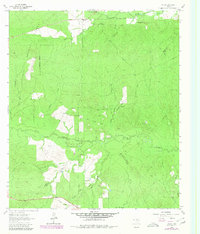
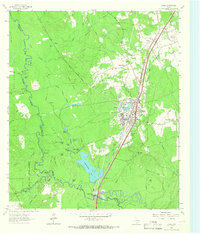
1963 Map of Trevat
USGS Topo · Published 1980About this map
Davy Crockett National Forest dominates the topography of this corner of East Texas, where the dense timber is carved by an intricate network of waterways. The small settlement of Trevat serves as a lone hub in the northern portion of the quadrangle, situated near the headwaters of Alabama Creek. To the south, the landscape is defined by the winding course of Piney Creek and its many tributaries, including Little Caney Creek and Sulphur Creek. The map documents a rural landscape where narrow roads and jeep trails provide the primary access through the forest and across the creek bottoms. Extensive woodland revisions reflect the changing canopy of the late 1970s, contrasting with the original topographic survey from the early 1960s to show the evolution of this pine-dominated environment.
Find a feature on this map
13 named features on this map. Tap any name to fly to it.
Don’t see what you’re looking for? This feature index may not catch every label — zoom into the map to look around manually.
Map Details
Editions of this 1963 Trevat Map
Other maps of this area

1953 · Palestine
USGS Topo · 1:250,000

1954 · Beaumont
USGS Topo · 1:250,000

1955 · New Willard
USGS Topo · 1:62,500

1957 · Beaumont
USGS Topo · 1:250,000

1957 · Palestine
USGS Topo · 1:250,000

1960 · Colita
USGS Topo · 1:24,000

1963 · Crecy
USGS Topo · 1:24,000

1963 · Groveton East
USGS Topo · 1:24,000
1963 · Apple Springs
USGS Topo · 1:24,000
1963 · Diboll
USGS Topo · 1:24,000