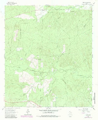
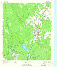
1963 Map of Trevat
USGS Topo · Published 1984About this map
Davy Crockett National Forest dominates this topographic landscape in East Texas, where the terrain is deeply etched by a complex network of waterways including Piney Creek, James Creek, and Sulphur Creek. The small community of Trevat serves as a primary point of reference in the northern portion of the quadrangle. The map reveals a rural economy rooted in the land, evidenced by a Gravel Pit and an extensive Pipeline network cutting through the timbered hills.
Find a feature on this map
23 named features on this map. Tap any name to fly to it.
Don’t see what you’re looking for? This feature index may not catch every label — zoom into the map to look around manually.
Map Details
Editions of this 1963 Trevat Map
Other maps of this area

1953 · Palestine
USGS Topo · 1:250,000

1954 · Beaumont
USGS Topo · 1:250,000

1955 · New Willard
USGS Topo · 1:62,500

1957 · Beaumont
USGS Topo · 1:250,000

1957 · Palestine
USGS Topo · 1:250,000

1960 · Colita
USGS Topo · 1:24,000

1963 · Crecy
USGS Topo · 1:24,000

1963 · Groveton East
USGS Topo · 1:24,000
1963 · Apple Springs
USGS Topo · 1:24,000
1963 · Diboll
USGS Topo · 1:24,000