Loading...
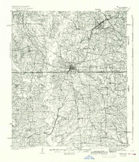
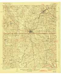
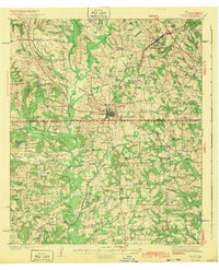
Loading map...1943 Map of Troup
USGS Topo · Published 1968About this map
The rural landscapes of East Texas are centered on Troup in this mid-century survey, where the Missouri Pacific railroad serves as the primary artery for the region's economy. The map reveals a dense network of small communities and social centers, such as St Clair City and Omen, alongside dozens of localized institutions like Henry Chapel Sch and Taylor Chapel. This pattern of settlement reflects the importance of rural schools and churches as the anchors of local life before the consolidation of the late 20th century.
Find a feature on this map
60 named features on this map. Tap any name to fly to it.
Don’t see what you’re looking for? This feature index may not catch every label — zoom into the map to look around manually.
Map Details
Date Portrayed1943
Date Published1968
PublisherU.S. Geological Survey
Map TypeTopographic
Scale1:62,500
Physical Dimensions18 x 21 inches
Editions of this 1943 Troup Map
Historical Maps of Whitehouse Through Time
1 maps found
Featured Locations
Source Details
SourceU.S. Geological Survey
CopyrightPublic Domain