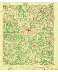
1943 Map of Troup
USGS Topo · Published 1943About this map
Troup serves as the central hub of this East Texas survey, situated at the junction of the Missouri Pacific railroad lines. The landscape is defined by the winding course of Mud Creek and its many tributaries, including Kickapoo Creek and Prairie Creek. To the north, the community of Arp is marked by a concentration of infrastructure, while the presence of an Oil Camp and various rural schools like Salem Sch and New Hope Sch point to an era of burgeoning energy production and decentralized community life.
Find a feature on this map
58 named features on this map. Tap any name to fly to it.
Don’t see what you’re looking for? This feature index may not catch every label — zoom into the map to look around manually.
Map Details
Editions of this 1943 Troup Map
Other maps of this area

1935 · Henderson
USGS Topo · 1:48,000

1936 · Kilgore
USGS Topo · 1:48,000

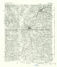
1937 · Troupe
USGS Topo · 1:48,000

1938 · Winona
USGS Topo · 1:48,000

1939 · Henderson
USGS Topo · 1:62,500

1940 · Kilgore
USGS Topo · 1:62,500

1943 · Troup
USGS Topo · 1:62,500

1943 · Winona
USGS Topo · 1:62,500

1943 · Cushing
USGS Topo · 1:62,500

1943 · Rusk
USGS Topo · 1:62,500