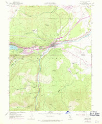
1955 Map of Truckee
USGS Topo · Published 1971About this map
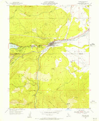
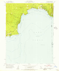
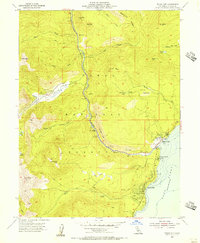
Murphy Cabin (Site) and Graves Cabin (Site) mark the eastern edge of Donner Memorial State Park in this mid-century record of the Sierra Nevada. The terrain is defined by the high elevations of Bald Mtn and Lookout Mtn, with the Southern Pacific railroad and the Truckee River carving a vital transit corridor through the town of Truckee. The map captures the community during a phase of growth, showing newer developments like the Tahoe-Truckee HS and Tahoe Forest Hospital alongside older landmarks like the Joerger Ranch. Significant industrial and timber history is preserved through labels for the Old Schaeffer Mill (Site) and Old Schaeffer Camp (Site) near Martis Creek. Further north, the recently developed Prosser Creek Reservoir and the Truckee-Tahoe Airport illustrate the area's evolving role as a regional transportation and recreation hub.
Find a feature on this map
50 named features on this map. Tap any name to fly to it.
Don’t see what you’re looking for? This feature index may not catch every label — zoom into the map to look around manually.
Map Details
Editions of this 1955 Truckee Map
5 editions found
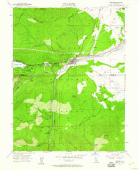
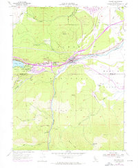
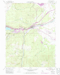
Other maps of this area

1891 · Truckee
USGS Topo · 1:125,000

1893 · Truckee
USGS Topo · 1:125,000

1895 · Truckee
USGS Topo · 1:125,000

1932 · Truckee
USGS Topo · 1:96,000

1940 · Truckee
USGS Topo · 1:125,000
1953 · Granite Chief
USGS Topo · 1:24,000
1953 · Granite Chief
USGS Topo · 1:62,500
1955 · Truckee
USGS Topo · 1:24,000
1955 · Kings Beach
USGS Topo · 1:24,000
1955 · Tahoe City
USGS Topo · 1:24,000