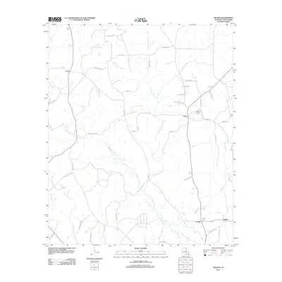
2012 Map of Truxno
USGS Topo · Published 2012About this map
Little Bayou de Loutre and its larger counterpart, Bayou de Loutre, define the drainage of this north Louisiana landscape near the Arkansas border. The rural network of roads, including John Bailey Rd, Green Bridge Rd, and Moshack Rd, connects small communities such as Truxno, Laran, and Conway. These settlements are historically anchored by their burial grounds, such as Laran Cem, Birds Chapel Cem, and Conway Cem, providing valuable points of interest for genealogists tracing local families. The presence of the Truxno Oil Field near Knight Rd and Slade Camp Rd points to the continued importance of the extraction industry in Union Parish. To the east, the community of Tugwell sits along the Meridian Cr drainage, while the swampy environment of Jackson Slough highlights the varying terrain of the Loutre basin.
Find a feature on this map
59 named features on this map. Tap any name to fly to it.
Don’t see what you’re looking for? This feature index may not catch every label — zoom into the map to look around manually.
Map Details
Editions of this 2012 Truxno Map
This is the sole edition of this map. No revisions or reprints were ever made.
Other maps of this area

1927 · El Dorado
USGS Topo · 1:62,500

1930 · El Dorado
USGS Topo · 1:62,500

1933 · Strong
USGS Topo · 1:62,500

1937 · Strong
USGS Topo · 1:62,500

1939 · Strong
USGS Topo · 1:62,500

1951 · Bernice
USGS Topo · 1:62,500

1951 · El Dorado
USGS Topo · 1:62,500

1952 · Farmerville
USGS Topo · 1:62,500

1953 · El Dorado
USGS Topo · 1:250,000

1955 · Shreveport
USGS Topo · 1:250,000