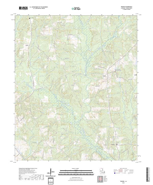
2024 Map of Truxno
USGS Topo · Published 2024About this map
The low-lying wetlands and sluggish waterways of northern Union Parish define this region, where Bayou de Loutre and its tributaries like Little Bayou de Loutre and Mark Beach Bayou wind through the landscape. The settlement of Truxno serves as a local focal point, situated near the intersection of several parish roads and the Bird's Chapel United Methodist Church. Further south, the community of Conway is anchored by the Conway Cem, reflecting the area's deep-rooted family histories.
Find a feature on this map
57 named features on this map. Tap any name to fly to it.
Don’t see what you’re looking for? This feature index may not catch every label — zoom into the map to look around manually.
Map Details
Editions of this 2024 Truxno Map
This is the sole edition of this map. No revisions or reprints were ever made.
Other maps of this area

1927 · El Dorado
USGS Topo · 1:62,500

1930 · El Dorado
USGS Topo · 1:62,500

1933 · Strong
USGS Topo · 1:62,500

1937 · Strong
USGS Topo · 1:62,500

1939 · Strong
USGS Topo · 1:62,500

1951 · Bernice
USGS Topo · 1:62,500

1951 · El Dorado
USGS Topo · 1:62,500

1952 · Farmerville
USGS Topo · 1:62,500

1953 · El Dorado
USGS Topo · 1:250,000

1955 · Shreveport
USGS Topo · 1:250,000