
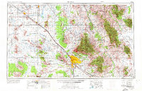
1956 Map of Tucson
USGS Topo · Published 1967About this map
The Santa Cruz River valley anchors this mid-century look at Southern Arizona, where the city of Tucson and South Tucson sit surrounded by high desert ranges and extensive federal lands. The map details a landscape of transition as established copper mining centers like the San Manuel Mine and Silver Bell Mine operate alongside growing aviation hubs including Davis-Monthan Air Force Base and the Tucson International Airport. The Southern Pacific RR tracks parallel major routes like U.S. 80 and U.S. 84, tracing the historical corridor of travel between Casa Grande and the southeastern mining districts.
Find a feature on this map
242 named features on this map. Tap any name to fly to it.
Don’t see what you’re looking for? This feature index may not catch every label — zoom into the map to look around manually.
Map Details
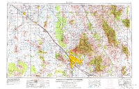
Editions of this 1956 Tucson Map
3 editions found
Other maps of this area

1900 · Florence
USGS Topo · 1:125,000

1902 · Florence
USGS Topo · 1:125,000

1904 · Patagonia
USGS Topo · 1:125,000

1904 · Tucson
USGS Topo · 1:125,000

1905 · Patagonia
USGS Topo · 1:125,000

1905 · Tucson
USGS Topo · 1:125,000

1907 · Sacaton
USGS Topo · 1:62,500

1910 · Ray
USGS Topo · 1:62,500

1911 · Winkelman
USGS Topo · 1:125,000

1913 · Winkelman
USGS Topo · 1:125,000