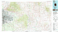
1994 Map of Tucson
USGS Topo · Published 1994About this map
The urban footprint of Tucson and South Tucson dominates the western portion of this 1994 survey, hemmed in by the massive protected landscapes of Saguaro National Monument and the Coronado National Forest. In the valley, the Southern Pacific railroad remains a primary transit artery, passing through rail-connected points like Wilmot, Esmond, and Vail. The San Xavier Indian Reservation and the sprawling Davis Monthan Air Force Base mark significant institutional and tribal land holdings that have shaped the city's growth patterns.
Find a feature on this map
52 named features on this map. Tap any name to fly to it.
Don’t see what you’re looking for? This feature index may not catch every label — zoom into the map to look around manually.
Map Details
Editions of this 1994 Tucson Map
2 editions found
Other maps of this area

1904 · Patagonia
USGS Topo · 1:125,000

1904 · Tucson
USGS Topo · 1:125,000

1905 · Patagonia
USGS Topo · 1:125,000

1905 · Tucson
USGS Topo · 1:125,000

1911 · Winkelman
USGS Topo · 1:125,000

1913 · Winkelman
USGS Topo · 1:125,000

1915 · Benson
USGS Topo · 1:125,000

1916 · Pearce
USGS Topo · 1:125,000

1920 · Arivaca
USGS Topo · 1:125,000

1922 · Willcox
USGS Topo · 1:125,000