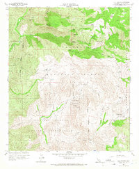
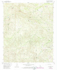
1960 Map of Tule Springs
USGS Topo · Published 1966About this map
Capitan Grande Indian Reservation dominates the central and southern portions of this landscape, where the San Diego River and Cedar Creek carve through the high terrain. The 1960 field check reveals a network of remote ranches and community sites, such as Rancho Alegria and the Wesley Boy Scout Camp located near Poverty Gulch. To the north, the terrain rises sharply toward Eagle Peak and Sunshine Mountain, featuring landmarks like the Devils Punch Bowl and the sheer drop of Cedar Creek Falls. This era shows a transition between traditional ranching and recreational use within the Cleveland National Forest. In the east, Echo Valley contains several established family holdings, including Sherilton Valley Ranch and Echo Dell Ranch, nestled along the banks of King Creek.
Find a feature on this map
57 named features on this map. Tap any name to fly to it.
Don’t see what you’re looking for? This feature index may not catch every label — zoom into the map to look around manually.
Map Details
Editions of this 1960 Tule Springs Map
5 editions found
Other maps of this area

1893 · El Cajon
USGS Topo · 1:62,500

1901 · Elcajon
USGS Topo · 1:62,500

1903 · Cuyamaca
USGS Topo · 1:125,000

1903 · Elcajon
USGS Topo · 1:62,500

1903 · Ramona
USGS Topo · 1:125,000

1904 · Southern California Sheet No. 2
USGS Topo · 1:250,000

1939 · El Cajon
USGS Topo · 1:62,500

1939 · Santa Ysabel
USGS Topo · 1:62,500

1942 · El Cajon
USGS Topo · 1:62,500

1942 · Ramona
USGS Topo · 1:62,500