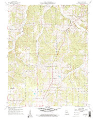
1960 Map of Tunas
USGS Topo · Published 1961About this map
The Little Niangua River winds through the eastern portion of this Dallas County region, providing a primary drainage for the surrounding hills and hollows. The settlement of Tunas sits near the river's bend, serving as a local hub for the surrounding townships of Lincoln, Sherman, Grant, and Jasper. The landscape is defined by its watercourses, from the northern Darby Branch to the Thomas Creek drainage in the west, which likely influenced the early road patterns and farm placements during the mid-twentieth century.
Find a feature on this map
20 named features on this map. Tap any name to fly to it.
Don’t see what you’re looking for? This feature index may not catch every label — zoom into the map to look around manually.
Map Details
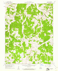
Editions of this 1960 Tunas Map
2 editions found
Other maps of this area

1884 · Bolivar
USGS Topo · 1:125,000

1892 · Bolivar
USGS Topo · 1:125,000

1934 · Macks Creek
USGS Topo · 1:48,000

1939 · Macks Creek
USGS Topo · 1:62,500

1939 · Long Lane
USGS Topo · 1:62,500

1942 · Long Lane
USGS Topo · 1:62,500

1950 · Buffalo NW
USGS Topo · 1:24,000

1950 · Urbana
USGS Topo · 1:24,000

1951 · Buffalo NW
USGS Topo · 1:24,000

1951 · Urbana
USGS Topo · 1:24,000