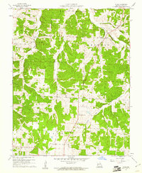
1960 Map of Tunas
USGS Topo · Published 1961About this map
The Little Niangua River winds through the eastern portion of this Dallas County landscape, defining the topography of the Sherman and Jasper townships. Centered on the community of Tunas, the area is characterized by a network of creeks and branches, including Thomas Creek and Monday Branch, which carve through the Ozark terrain. This 1960 field-checked survey reveals a quiet rural layout where local life is anchored by landmarks like Howard Chapel in the west and Cherry Grove Ch to the south. The map provides a precise look at the land before modern expansion, capturing the placement of small local roads, a Gravel Pit, and the several small cemeteries that dot the hillsides. The township boundaries of Lincoln and Grant divide the western half of the quadrangle, illustrating the formal land organization of the mid-20th century Missouri Ozarks.
Find a feature on this map
14 named features on this map. Tap any name to fly to it.
Don’t see what you’re looking for? This feature index may not catch every label — zoom into the map to look around manually.
Map Details
Editions of this 1960 Tunas Map
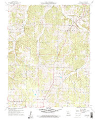
2 editions found
Other maps of this area

1884 · Bolivar
USGS Topo · 1:125,000

1892 · Bolivar
USGS Topo · 1:125,000

1934 · Macks Creek
USGS Topo · 1:48,000

1939 · Macks Creek
USGS Topo · 1:62,500

1939 · Long Lane
USGS Topo · 1:62,500

1942 · Long Lane
USGS Topo · 1:62,500

1950 · Buffalo NW
USGS Topo · 1:24,000

1950 · Urbana
USGS Topo · 1:24,000

1951 · Buffalo NW
USGS Topo · 1:24,000

1951 · Urbana
USGS Topo · 1:24,000