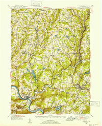
1946 Map of Tunkhannock
USGS Topo · Published 1952About this map
Tunkhannock sits at the confluence of the Susquehanna River and Tunkhannock Creek, serving as a central hub for the valley's mid-century transport network. In the 1940s, this region of Northeastern Pennsylvania was defined by its dual rail systems, with the Lehigh Valley Railroad tracking the river and the Delaware Lackawanna & Western RR serving Nicholson and Factoryville Sta. The landscape is dotted with numerous small settlements and family-named hills, such as Avery Hill and Jennings Hill, reflecting a deep genealogical footprint in the townships of Springville and Lathrop.
Find a feature on this map
165 named features on this map. Tap any name to fly to it.
Don’t see what you’re looking for? This feature index may not catch every label — zoom into the map to look around manually.
Map Details
Editions of this 1946 Tunkhannock Map

Other maps of this area

1889 · Scranton
USGS Topo · 1:62,500

1891 · Scranton
USGS Topo · 1:62,500

1891 · Harveys Lake
USGS Topo · 1:62,500

1892 · Dundaff
USGS Topo · 1:62,500

1893 · Harvey Lake
USGS Topo · 1:62,500

1893 · Pittston
USGS Topo · 1:62,500

1893 · Scranton
USGS Topo · 1:62,500

1932 · Susquehanna
USGS Topo · 1:62,500

1935 · Susquehanna
USGS Topo · 1:62,500

1943 · Scranton
USGS Topo · 1:125,000