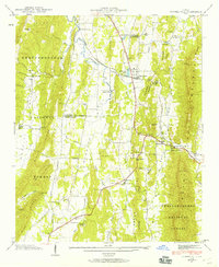
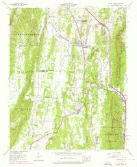
1943 Map of Tunnel Hill
USGS Topo · Published 1960About this map
Tunnel Hill sits at a critical rail passage through the North Georgia ridges, where the Nashville Chattanooga and St Louis RR pierces the heights of Tunnel Hill Ridge. The landscape in the mid-1940s was defined by a series of parallel north-south ridges, including Taylor Ridge and Dick Ridge, which channeled settlement and transportation into long, narrow valleys. Agricultural life is evidenced by the numerous country churches and family burial grounds that dot the terrain, such as New Hope Ch, Dogwood Cem, and Stony Point Cem.
Find a feature on this map
54 named features on this map. Tap any name to fly to it.
Don’t see what you’re looking for? This feature index may not catch every label — zoom into the map to look around manually.
Map Details
Editions of this 1943 Tunnel Hill Map
5 editions found
Other maps of this area

1886 · Dalton
USGS Topo · 1:125,000

1886 · Ringgold
USGS Topo · 1:125,000

1892 · Ringgold
USGS Topo · 1:125,000

1892 · Dalton
USGS Topo · 1:125,000

1897 · Dalton
USGS Topo · 1:125,000

1935 · Catlett
USGS Topo · 1:24,000

1935 · East Ridge
USGS Topo · 1:24,000
1935 · Tiger Creek
USGS Topo · 1:24,000

1935 · Villanow
USGS Topo · 1:24,000

1935 · Ringgold
USGS Topo · 1:24,000