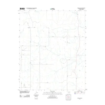
2012 Map of Tupelo NE
USGS Topo · Published 2012About this map
Boiling Spring Indian Cem and Globe Cem are notable landmarks on this Coal County landscape, marking the cultural and familial history of this rural Oklahoma region. The terrain is defined by a dense network of tributaries including Rock Cr, Cedar Cr, and Black Cr, which drain into the larger Muddy Boggy Cr that meanders through the northeast corner. This 2012 survey illustrates the modern grid of section roads, such as n3740 RD and e1600 RD, that navigate around numerous small ponds and creek beds. The drainage patterns of Turkey Cr, Peach Cr, and Owl Cr in the southern portion of the quadrangle suggest a rolling prairie landscape predominantly utilized for agriculture and ranching, characteristic of the area north of Tupelo.
Find a feature on this map
28 named features on this map. Tap any name to fly to it.
Don’t see what you’re looking for? This feature index may not catch every label — zoom into the map to look around manually.
Map Details
Editions of this 2012 Tupelo NE Map
This is the sole edition of this map. No revisions or reprints were ever made.
Other maps of this area

1896 · Coalgate
USGS Topo · 1:125,000

1899 · Coalgate
USGS Topo · 1:125,000

1900 · Coalgate
USGS Topo · 1:125,000

1957 · Coalgate
USGS Topo · 1:24,000

1957 · Centrahoma
USGS Topo · 1:24,000

1957 · Tupelo NE
USGS Topo · 1:24,000

1957 · Ardmore
USGS Topo · 1:250,000

1958 · Lula
USGS Topo · 1:24,000

1958 · Steedman
USGS Topo · 1:24,000

1963 · Ardmore
USGS Topo · 1:250,000