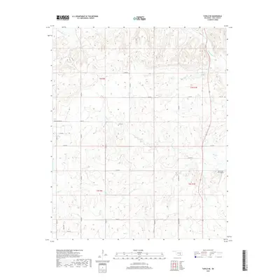
2018 Map of Tupelo NE
USGS Topo · Published 2018About this map
Muddy Boggy Cr and its numerous tributaries dominate this Coal County landscape, carving a dense network of drainage patterns through the Oklahoma terrain. The map area is defined by a rural section-line road grid, where travel follows routes like Louis Cemetery Rd and Legal Rd. Local history is anchored at the central Globe Cem, while the northern reaches are marked by the branching waters of Sandy Cr and Cedar Cr. Evidence of modern land use appears at the Rock Creek Farm Airport in the east, situated near the banks of Rock Cr. The topography reveals a complex system of ridges and valleys, particularly surrounding the southern watersheds of Turkey Cr, Black Cr, and Owl Cr, illustrating the deeply dissected nature of this rural territory.
Find a feature on this map
26 named features on this map. Tap any name to fly to it.
Don’t see what you’re looking for? This feature index may not catch every label — zoom into the map to look around manually.
Map Details
Editions of this 2018 Tupelo NE Map
This is the sole edition of this map. No revisions or reprints were ever made.
Other maps of this area

1896 · Coalgate
USGS Topo · 1:125,000

1899 · Coalgate
USGS Topo · 1:125,000

1900 · Coalgate
USGS Topo · 1:125,000

1957 · Coalgate
USGS Topo · 1:24,000

1957 · Centrahoma
USGS Topo · 1:24,000

1957 · Tupelo NE
USGS Topo · 1:24,000

1957 · Ardmore
USGS Topo · 1:250,000

1958 · Lula
USGS Topo · 1:24,000

1958 · Steedman
USGS Topo · 1:24,000

1963 · Ardmore
USGS Topo · 1:250,000