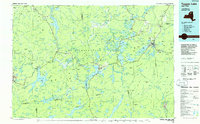
1985 Map of Tupper Lake
USGS Topo · Published 1986About this map
Saranac Lake and the village of Tupper Lake serve as the primary hubs in this mid-1980s look at the central Adirondacks. The landscape is defined by the complex network of water bodies and peaks across five counties, including Cranberry Lake, Lows Lake, and the Santanoni Mountains. This era shows the continued importance of the Adirondack RR corridor as it threads through isolated settlements like Sabattis and Childwold Sta.
Find a feature on this map
326 named features on this map. Tap any name to fly to it.
Don’t see what you’re looking for? This feature index may not catch every label — zoom into the map to look around manually.
Map Details
Editions of this 1985 Tupper Lake Map
2 editions found
Other maps of this area

1895 · Mt. Marcy
USGS Topo · 1:62,500

1896 · Lake Placid
USGS Topo · 1:62,500

1897 · Schroon Lake
USGS Topo · 1:62,500

1898 · Newcomb
USGS Topo · 1:62,500

1898 · Lake Placid
USGS Topo · 1:62,500

1901 · Newcomb
USGS Topo · 1:62,500

1902 · Mt. Marcy
USGS Topo · 1:62,500

1902 · Saranac
USGS Topo · 1:62,500

1903 · Big Moose
USGS Topo · 1:62,500

1903 · Raquette Lake
USGS Topo · 1:62,500