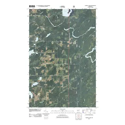
2011 Map of Turpela Lake
USGS Topo · Published 2011About this map
The Saint Louis River winds through this northern landscape, joined by the Partridge River and Water Hen Creek in a complex drainage network characteristic of Saint Louis County. Human infrastructure is subtly etched into the terrain, most notably at the White Water Reservoir Dam which regulates Whitewater Lake in the northeastern corner. The area is defined by a series of small, scattered lakes including Turpela Lake, South Twin Lake, and Neff Lake, many of which carry family names like Hautala Lake and Kumpula Lake. A grid of rural roads and forest routes, such as Trigstad Rd and Palo Road 41, provides access to the timberlands and shoreline property. Near a sharp bend in the river, Norway Point stands as a distinct landmark in this wetland-rich environment.
Find a feature on this map
27 named features on this map. Tap any name to fly to it.
Don’t see what you’re looking for? This feature index may not catch every label — zoom into the map to look around manually.
Map Details
Editions of this 2011 Turpela Lake Map
This is the sole edition of this map. No revisions or reprints were ever made.
Other maps of this area

1949 · Aurora
USGS Topo · 1:24,000

1949 · Allen
USGS Topo · 1:24,000

1950 · Allen
USGS Topo · 1:24,000

1950 · Aurora
USGS Topo · 1:24,000

1950 · Biwabik
USGS Topo · 1:24,000

1951 · Biwabik
USGS Topo · 1:24,000

1951 · Palo
USGS Topo · 1:24,000

1951 · Makinen
USGS Topo · 1:24,000

1954 · Hibbing
USGS Topo · 1:250,000

1957 · Hibbing
USGS Topo · 1:250,000