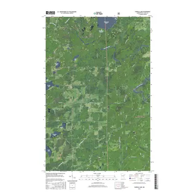
2016 Map of Turpela Lake
USGS Topo · Published 2016About this map
Superior National Forest encompasses much of this landscape, where the Saint Louis River and Partridge River wind through the wetland-rich terrain of Saint Louis County. This 2016 survey illustrates a complex water system including the White Water Reservoir and Whitewater Lake to the north, along with smaller bodies like Turpela Lake, Hautala Lake, and Kumpula Lake. The map reveals a specialized transportation network dominated by forest roads and historic designations like Mooseline and Pequaywan. A singular named landmark, Koivisto, sits central to the quadrant, likely representing a local family name or established homestead within the forest boundary. The grid of forest service roads, such as Trigstad Rd and Palo Road 41, provides access to these remote northern woods, while features like Norway Point offer distinct navigational references for those navigating the river bends.
Find a feature on this map
48 named features on this map. Tap any name to fly to it.
Don’t see what you’re looking for? This feature index may not catch every label — zoom into the map to look around manually.
Map Details
Editions of this 2016 Turpela Lake Map
This is the sole edition of this map. No revisions or reprints were ever made.
Other maps of this area

1949 · Aurora
USGS Topo · 1:24,000

1949 · Allen
USGS Topo · 1:24,000

1950 · Allen
USGS Topo · 1:24,000

1950 · Aurora
USGS Topo · 1:24,000

1950 · Biwabik
USGS Topo · 1:24,000

1951 · Biwabik
USGS Topo · 1:24,000

1951 · Palo
USGS Topo · 1:24,000

1951 · Makinen
USGS Topo · 1:24,000

1954 · Hibbing
USGS Topo · 1:250,000

1957 · Hibbing
USGS Topo · 1:250,000