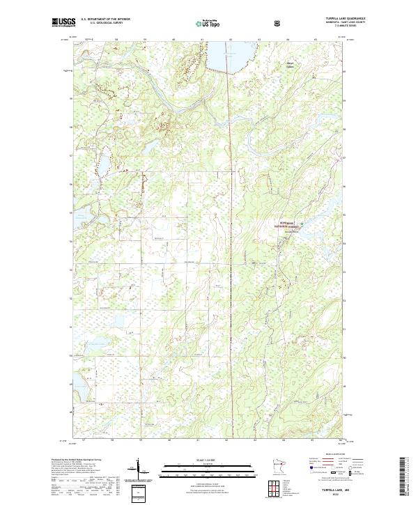
2022 Map of Turpela Lake
USGS Topo · Published 2022About this map
Superior National Forest encompasses much of this northeastern Minnesota landscape, where the Saint Louis River and Partridge River wind through thick woodland and marsh. The area around Hoyt Lakes and the high ground at Norway Point reflect the region's industrial and logging heritage, marked by an extensive network of specialized tracks and trails. These include the Mooseline Spur 791, Mooseline Spur 130ka Trl, and Kolvisto Spur A Trl, which speak to the historic movement of timber and ore through the Saint Louis County backcountry. Several remote water bodies, such as Whitewater Lake, South Twin Lake, and Kumpula Lake, define the local drainage patterns and provide reference points for land navigation in this densely forested terrain.
Find a feature on this map
50 named features on this map. Tap any name to fly to it.
Don’t see what you’re looking for? This feature index may not catch every label — zoom into the map to look around manually.
Map Details
Editions of this 2022 Turpela Lake Map
This is the sole edition of this map. No revisions or reprints were ever made.
Other maps of this area

1949 · Aurora
USGS Topo · 1:24,000

1949 · Allen
USGS Topo · 1:24,000

1950 · Allen
USGS Topo · 1:24,000

1950 · Aurora
USGS Topo · 1:24,000

1950 · Biwabik
USGS Topo · 1:24,000

1951 · Biwabik
USGS Topo · 1:24,000

1951 · Palo
USGS Topo · 1:24,000

1951 · Makinen
USGS Topo · 1:24,000

1954 · Hibbing
USGS Topo · 1:250,000

1957 · Hibbing
USGS Topo · 1:250,000