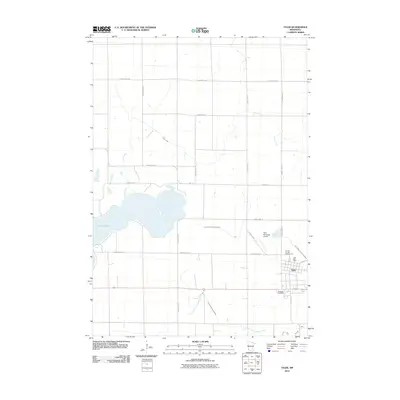
2010 Map of Tyler
USGS Topo · Published 2010About this map
Tyler serves as the primary hub for this southwestern Minnesota agricultural landscape, situated at the intersection of a dense network of county highways and local roads. The town's layout is clearly defined, including the Tyler Post Office and the Lincoln County Fairgrounds on its western edge. To the south, the Danebod Cemetery offers a significant point of interest for genealogists and local historians, while the Tyler Municipal Airport stands just northwest of the main settlement.
Find a feature on this map
24 named features on this map. Tap any name to fly to it.
Don’t see what you’re looking for? This feature index may not catch every label — zoom into the map to look around manually.
Map Details
Editions of this 2010 Tyler Map
This is the sole edition of this map. No revisions or reprints were ever made.
Other maps of this area

1953 · Watertown
USGS Topo · 1:250,000

1958 · Watertown
USGS Topo · 1:250,000

1963 · Dead Coon Lake
USGS Topo · 1:24,000

1963 · Gislason Lake
USGS Topo · 1:24,000

1963 · Tyler
USGS Topo · 1:24,000

1963 · Arco
USGS Topo · 1:24,000
1967 · Ruthton
USGS Topo · 1:24,000

1967 · Ruthton NW
USGS Topo · 1:24,000

1967 · Verdi
USGS Topo · 1:24,000

1967 · Lake Benton
USGS Topo · 1:24,000