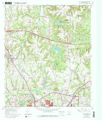
1966 Map of Tyler North
USGS Topo · Published 1975About this map
Tyler State Park and the northern outskirts of Tyler anchor this mid-1960s survey of Smith County. The landscape is defined by the headwaters of the Black Fork Creek and Saline Creek, where numerous Oil Wells punctuate the wooded hills and creek valleys. This era shows the city's northward expansion alongside long-established rural nodes like Swan and Shady Grove. Genealogical value is found in the distribution of family-centered landmarks and community centers, including the Old Butler Cem, Antioch Ch, and the Pine Springs Sch. Transport infrastructure is dominated by the Missouri Pacific and St Louis Southwestern railroads, which helped facilitate the region's agricultural and industrial growth. The northern presence of Texas College and the State Agricultural Experiment Station reflects the area's historical role in education and agricultural research.
Find a feature on this map
42 named features on this map. Tap any name to fly to it.
Don’t see what you’re looking for? This feature index may not catch every label — zoom into the map to look around manually.
Map Details
Editions of this 1966 Tyler North Map
2 editions found
Other maps of this area

1938 · Winona
USGS Topo · 1:48,000

1943 · Winona
USGS Topo · 1:62,500

1948 · Tyler
USGS Topo · 1:62,500

1949 · Tyler
USGS Topo · 1:62,500

1956 · Tyler
USGS Topo · 1:250,000

1960 · Hawkins
USGS Topo · 1:24,000

1960 · Lindale
USGS Topo · 1:24,000

1960 · Crow
USGS Topo · 1:24,000

1966 · Chandler
USGS Topo · 1:24,000
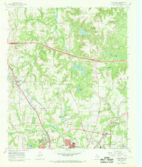
1966 · Tyler North
USGS Topo · 1:24,000