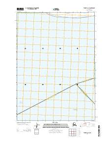
2013 Map of Tyonek A-2 NE
USGS Topo · Published 2013About this map
The waters of the Pacific Ocean and the sprawling wetlands of the Susitna Flats dominate this coastal survey. Located at the convergence of three major administrative boundaries, the map highlights the intersection of the Matanuska-Susitna Borough, the Anchorage Municipality, and the Kenai Peninsula Borough. The landscape is primarily aquatic and intertidal, characterized by the shallow hazards of the Fire Island Shoal in the southeast quadrant. This document serves as a precise record of the shoreline and jurisdictional lines in the Cook Inlet region, where the sediment-heavy waters of the Susitna River delta meet the sea. The sparse overland features emphasize the transition from the low-lying flats to the open waters of the inlet, providing a clear picture of the region's complex maritime and political geography.
Find a feature on this map
10 named features on this map. Tap any name to fly to it.
Don’t see what you’re looking for? This feature index may not catch every label — zoom into the map to look around manually.
Map Details
Editions of this 2013 Tyonek A-2 NE Map
This is the sole edition of this map. No revisions or reprints were ever made.
Other maps of this area

1949 · Tyonek
USGS Topo · 1:250,000

1951 · Tyonek
USGS Topo · 1:250,000

1951 · Tyonek A-2
USGS Topo · 1:63,360

1951 · Tyonek A-1
USGS Topo · 1:63,360

1952 · Tyonek A-2
USGS Topo · 1:63,360

1952 · Tyonek A-1
USGS Topo · 1:63,360

1958 · Tyonek B-1
USGS Topo · 1:63,360

1958 · Tyonek B-2
USGS Topo · 1:63,360

1958 · Tyonek
USGS Topo · 1:250,000

1965 · Tyonek
USGS Topo · 1:250,000