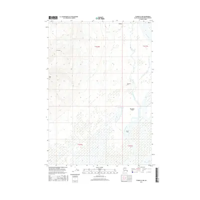
2016 Map of Tyonek B-2 NW
USGS Topo · Published 2016About this map
Mt Susitna dominates the western horizon of this Alaskan landscape, with its South Peak rising sharply above the surrounding wetlands and river systems. The map captures the complex hydrology where the Susitna River and Alexander Creek converge, creating a network of intricate waterways like Casper Slough and the uniquely named K'ti'ila Te'ilht. This area of the Matanuska-Susitna Borough is characterized by isolated settlements and geographic landmarks such as Dinglishna Hill, which stands as a prominent point amidst the low-lying basin.
Find a feature on this map
16 named features on this map. Tap any name to fly to it.
Don’t see what you’re looking for? This feature index may not catch every label — zoom into the map to look around manually.
Map Details
Editions of this 2016 Tyonek B-2 NW Map
This is the sole edition of this map. No revisions or reprints were ever made.
Other maps of this area

1949 · Tyonek
USGS Topo · 1:250,000

1951 · Tyonek
USGS Topo · 1:250,000

1954 · Tyonek C-3
USGS Topo · 1:63,360

1958 · Tyonek C-2
USGS Topo · 1:63,360

1958 · Tyonek B-3
USGS Topo · 1:63,360

1958 · Tyonek B-2
USGS Topo · 1:63,360

1958 · Tyonek
USGS Topo · 1:250,000

1965 · Tyonek
USGS Topo · 1:250,000
1993 · Tyonek C-3
USGS Topo · 1:63,360
1993 · Tyonek C-2
USGS Topo · 1:63,360