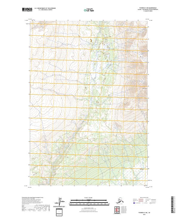
2023 Map of Tyonek B-3 NE
USGS Topo · Published 2023About this map
Susitna sits at the eastern edge of a landscape defined by braided waterways and glacial drainages within the Matanuska-Susitna Borough. This modern data illustrates the intricate hydrography of the region, where the Lewis River and Ivan River flow through a complex network of wetlands and shifting channels toward the Cook Inlet. To the northeast, the terrain rises sharply toward South Peak, providing a stark contrast between the low-lying river plains and the higher elevations of the surrounding mountains. The presence of Wolverine Creek further highlights the delicate balance of this watery environment, which remains largely roadless and dominated by natural processes. The map provides a contemporary perspective on the township and range divisions, specifically t16n r9w and t15n r8w, which organize this expansive subarctic wilderness.
Find a feature on this map
9 named features on this map. Tap any name to fly to it.
Don’t see what you’re looking for? This feature index may not catch every label — zoom into the map to look around manually.
Map Details
Editions of this 2023 Tyonek B-3 NE Map
This is the sole edition of this map. No revisions or reprints were ever made.
Other maps of this area

1949 · Tyonek
USGS Topo · 1:250,000

1951 · Tyonek
USGS Topo · 1:250,000

1954 · Tyonek C-3
USGS Topo · 1:63,360

1958 · Tyonek C-2
USGS Topo · 1:63,360

1958 · Tyonek B-3
USGS Topo · 1:63,360

1958 · Tyonek B-2
USGS Topo · 1:63,360

1958 · Tyonek
USGS Topo · 1:250,000

1965 · Tyonek
USGS Topo · 1:250,000
1993 · Tyonek C-3
USGS Topo · 1:63,360
1993 · Tyonek C-2
USGS Topo · 1:63,360