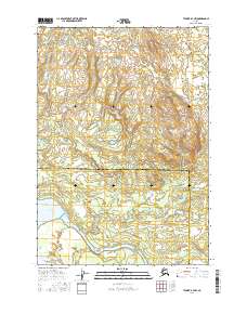
2016 Map of Tyonek B-4 NW
USGS Topo · Published 2016About this map
The Matanuska-Susitna Borough and Kenai Peninsula Borough boundary bisects this landscape, marking a transition between the elevated northern terrain and the marshy river basins to the south. The hydrological network is dominated by the broad course of the Beluga River, which flows out of the expansive Beluga Lake. This area of the Cook Inlet region shows a complex system of wetlands and small tributaries, including the southern Chichantna River and the small channel of Drill Cr. The absence of roads or established settlements emphasizes the remote, water-defined character of this territory in the mid-2010s, where the landscape is shaped primarily by glacial drainage and shifting riparian corridors.
Find a feature on this map
9 named features on this map. Tap any name to fly to it.
Don’t see what you’re looking for? This feature index may not catch every label — zoom into the map to look around manually.
Map Details
Editions of this 2016 Tyonek B-4 NW Map
This is the sole edition of this map. No revisions or reprints were ever made.
Other maps of this area

1949 · Tyonek
USGS Topo · 1:250,000

1951 · Tyonek
USGS Topo · 1:250,000

1954 · Tyonek C-5
USGS Topo · 1:63,360

1954 · Tyonek C-4
USGS Topo · 1:63,360

1954 · Tyonek B-4
USGS Topo · 1:63,360

1958 · Tyonek B-5
USGS Topo · 1:63,360

1958 · Tyonek
USGS Topo · 1:250,000

1965 · Tyonek
USGS Topo · 1:250,000
2013 · Tyonek B-5 SE
USGS Topo · 1:25,000
2013 · Tyonek B-4 SW
USGS Topo · 1:25,000