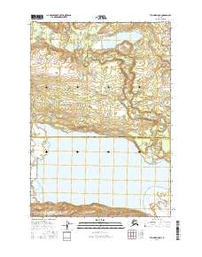
2016 Map of Tyonek B-5 NE
USGS Topo · Published 2016About this map
Beluga Lake dominates the southern landscape of this 2016 survey, a massive freshwater body that defines the hydrology of the western Cook Inlet region. This portion of the Matanuska-Susitna and Kenai Peninsula Borough border reflects a complex network of glacial and tundra drainage systems. The northern terrain is characterized by the winding path of Coal Creek and its source at Coal Creek Lake, revealing the intricate tributary patterns including the W Fork Coal Cr. Along the southeastern margin, the Chichantna River flows toward the lake, illustrating the high-volume water systems typical of this Alaskan wilderness. The map provides a clear look at the intersection of public land surveys and natural hydrology in a region primarily defined by its waterways rather than road infrastructure.
Find a feature on this map
10 named features on this map. Tap any name to fly to it.
Don’t see what you’re looking for? This feature index may not catch every label — zoom into the map to look around manually.
Map Details
Editions of this 2016 Tyonek B-5 NE Map
This is the sole edition of this map. No revisions or reprints were ever made.
Other maps of this area

1949 · Tyonek
USGS Topo · 1:250,000

1951 · Tyonek
USGS Topo · 1:250,000

1954 · Tyonek C-5
USGS Topo · 1:63,360

1954 · Tyonek C-4
USGS Topo · 1:63,360

1954 · Tyonek B-4
USGS Topo · 1:63,360

1958 · Tyonek B-5
USGS Topo · 1:63,360

1958 · Tyonek
USGS Topo · 1:250,000

1965 · Tyonek
USGS Topo · 1:250,000
2013 · Tyonek B-5 SE
USGS Topo · 1:25,000
2013 · Tyonek B-5 SW
USGS Topo · 1:25,000