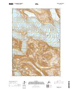
2017 Map of Tyonek B-6 NE
USGS Topo · Published 2017About this map
The glacial landscape of the Matanuska-Susitna Borough and Kenai Peninsula Borough border is defined by massive ice movements and isolated alpine lakes. The eastern portion of the sheet is dominated by the Triumvirate Glacier, which carved the surrounding high-altitude terrain, while the Dogshead Glacier occupies the southwestern reaches. Between these frozen features, high-elevation water bodies like Strandline Lake and Frustration Lake sit in the rocky basins of the Alaska Range. This 2017 survey illustrates a wilderness where natural boundaries are dictated by ice and elevation rather than human settlement, preserving a record of these shifting glacial margins at the start of the 21st century.
Find a feature on this map
9 named features on this map. Tap any name to fly to it.
Don’t see what you’re looking for? This feature index may not catch every label — zoom into the map to look around manually.
Map Details
Editions of this 2017 Tyonek B-6 NE Map
This is the sole edition of this map. No revisions or reprints were ever made.
Other maps of this area

1949 · Tyonek
USGS Topo · 1:250,000

1951 · Tyonek
USGS Topo · 1:250,000

1954 · Tyonek C-5
USGS Topo · 1:63,360

1958 · Tyonek C-6
USGS Topo · 1:63,360

1958 · Tyonek B-5
USGS Topo · 1:63,360

1958 · Tyonek B-6
USGS Topo · 1:63,360

1958 · Tyonek
USGS Topo · 1:250,000

1965 · Tyonek
USGS Topo · 1:250,000
2013 · Tyonek B-5 SW
USGS Topo · 1:25,000
2016 · Tyonek B-6 SE
USGS Topo · 1:25,000