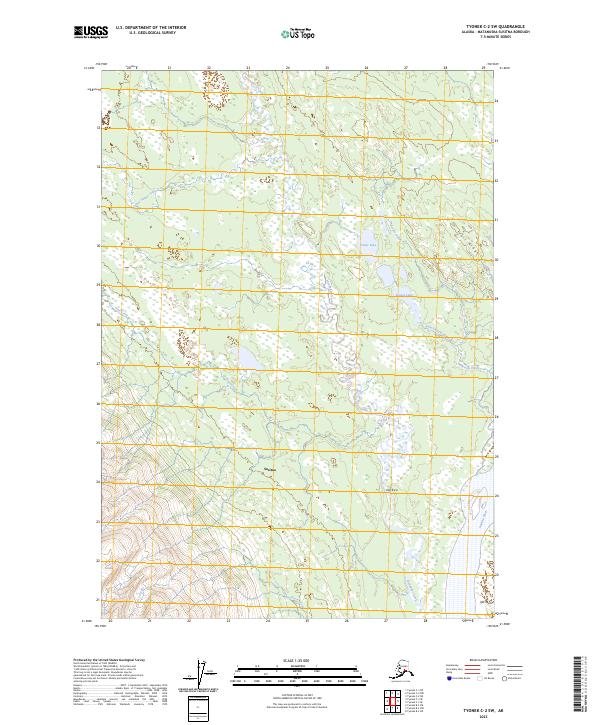
2023 Map of Tyonek C-2 SW
USGS Topo · Published 2023About this map
Susitna and the winding course of the Susitna River dominate this portion of the Matanuska-Susitna Borough, where an intricate network of waterways defines the landscape. The movement of water through Alexander Creek, Anderson Creek, and Kala Chaq'a Betnu illustrates the complex drainage patterns of this Alaskan interior. These riparian corridors have historically served as vital lifelines for travel and subsistence, connecting localized terrain features like Trail Ridge and Ken Ka'a.
Find a feature on this map
19 named features on this map. Tap any name to fly to it.
Don’t see what you’re looking for? This feature index may not catch every label — zoom into the map to look around manually.
Map Details
Editions of this 2023 Tyonek C-2 SW Map
This is the sole edition of this map. No revisions or reprints were ever made.
Other maps of this area

1949 · Tyonek
USGS Topo · 1:250,000

1951 · Tyonek
USGS Topo · 1:250,000

1954 · Tyonek C-3
USGS Topo · 1:63,360

1958 · Tyonek C-2
USGS Topo · 1:63,360

1958 · Tyonek B-3
USGS Topo · 1:63,360

1958 · Tyonek B-2
USGS Topo · 1:63,360

1958 · Tyonek
USGS Topo · 1:250,000

1965 · Tyonek
USGS Topo · 1:250,000
1993 · Tyonek C-3
USGS Topo · 1:63,360
1993 · Tyonek C-2
USGS Topo · 1:63,360