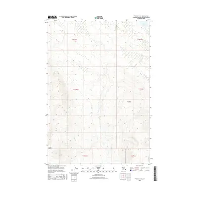
2016 Map of Tyonek C-3 SE
USGS Topo · Published 2016About this map
Little Mt Susitna rises in the southwestern corner of this landscape, anchoring a wilderness terrain defined by complex drainage patterns in the Matanuska-Susitna Borough. The area is dominated by the Susitna region's network of waterways, where the waters of Upper Sucker Cr and Wolverine Cr navigate the varying elevations. In the northeast, Trail Lake serves as a significant landmark, fed by Trail Cr and situated near the transition to Lower Sucker Cr. The lack of developed roads or settlements on this 2016 survey emphasizes the area's character as an untouched interior expanse, shaped primarily by natural features like Snag Cr rather than human industry. The map captures the intricate topographic contouring of the foothills, providing a clear record of the physical geography before any modern infrastructure altered the drainage basins.
Find a feature on this map
14 named features on this map. Tap any name to fly to it.
Don’t see what you’re looking for? This feature index may not catch every label — zoom into the map to look around manually.
Map Details
Editions of this 2016 Tyonek C-3 SE Map
This is the sole edition of this map. No revisions or reprints were ever made.
Other maps of this area

1949 · Tyonek
USGS Topo · 1:250,000

1951 · Tyonek
USGS Topo · 1:250,000

1954 · Tyonek C-3
USGS Topo · 1:63,360

1958 · Tyonek C-2
USGS Topo · 1:63,360

1958 · Tyonek B-3
USGS Topo · 1:63,360

1958 · Tyonek B-2
USGS Topo · 1:63,360

1958 · Tyonek
USGS Topo · 1:250,000

1965 · Tyonek
USGS Topo · 1:250,000
1993 · Tyonek C-3
USGS Topo · 1:63,360
1993 · Tyonek C-2
USGS Topo · 1:63,360