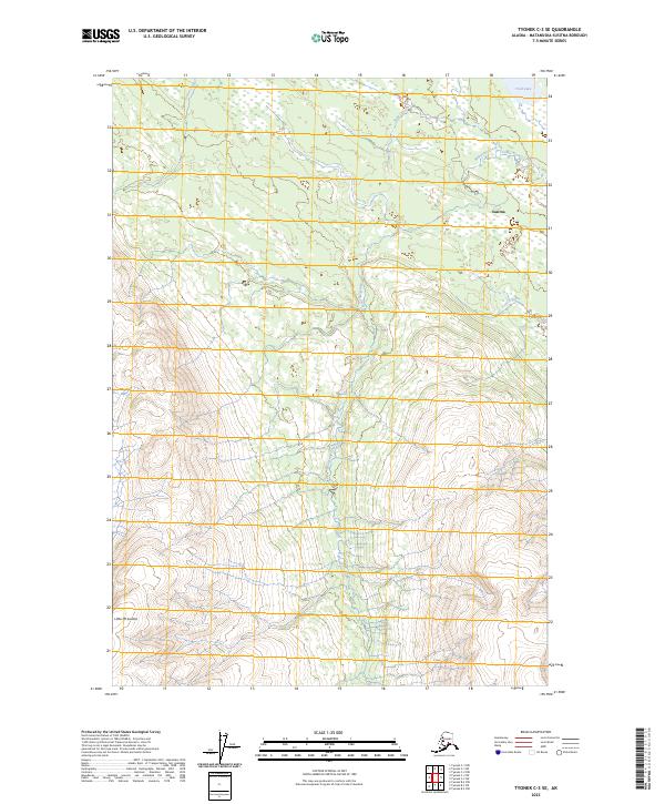
2023 Map of Tyonek C-3 SE
USGS Topo · Published 2023About this map
The settlement of Susitna sits at a crossroads of waterways and high terrain in this interior Alaskan landscape. To the southwest, the prominent rise of Little Mt Susitna anchors the topography, while a complex network of drainage systems defines the low-lying areas. The hydrology is dominated by the parallel courses of Upper Sucker Creek and Lower Sucker Creek, alongside the winding paths of Wolverine Creek and Snag Creek. Researchers of the Matanuska-Susitna region will find the proximity of Trail Lake and Trail Creek particularly significant for understanding historical movement and seasonal access through this portion of the borough. The map reveals a wilderness landscape where small-scale settlement remains closely tied to the natural corridors provided by these streams and the varying elevations of the Susitna River valley.
Find a feature on this map
14 named features on this map. Tap any name to fly to it.
Don’t see what you’re looking for? This feature index may not catch every label — zoom into the map to look around manually.
Map Details
Editions of this 2023 Tyonek C-3 SE Map
This is the sole edition of this map. No revisions or reprints were ever made.
Other maps of this area

1949 · Tyonek
USGS Topo · 1:250,000

1951 · Tyonek
USGS Topo · 1:250,000

1954 · Tyonek C-3
USGS Topo · 1:63,360

1958 · Tyonek C-2
USGS Topo · 1:63,360

1958 · Tyonek B-3
USGS Topo · 1:63,360

1958 · Tyonek B-2
USGS Topo · 1:63,360

1958 · Tyonek
USGS Topo · 1:250,000

1965 · Tyonek
USGS Topo · 1:250,000
1993 · Tyonek C-3
USGS Topo · 1:63,360
1993 · Tyonek C-2
USGS Topo · 1:63,360