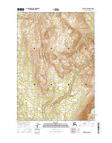
2016 Map of Tyonek C-3 SW
USGS Topo · Published 2016About this map
Theodore River winds through this expanse of the Matanuska-Susitna Borough, defining a drainage pattern that characterizes this corner of Southcentral Alaska. The terrain is marked by the presence of Little Mt Susitna in the southeastern portion of the map, rising above the surrounding lowlands and wetlands. The drainage of Upper Sucker Cr cuts through the northeastern reaches, part of a complex hydrologic network documented by the National Hydrography Dataset. This survey reflects the undeveloped character of the landscape in the mid-2010s, where the natural flow of the rivers remains the primary geographic feature amidst the vast townships and ranges of the Public Land Survey System.
Find a feature on this map
9 named features on this map. Tap any name to fly to it.
Don’t see what you’re looking for? This feature index may not catch every label — zoom into the map to look around manually.
Map Details
Editions of this 2016 Tyonek C-3 SW Map
This is the sole edition of this map. No revisions or reprints were ever made.
Other maps of this area

1949 · Tyonek
USGS Topo · 1:250,000

1951 · Tyonek
USGS Topo · 1:250,000

1954 · Tyonek C-4
USGS Topo · 1:63,360

1954 · Tyonek B-4
USGS Topo · 1:63,360

1954 · Tyonek C-3
USGS Topo · 1:63,360

1958 · Tyonek B-3
USGS Topo · 1:63,360

1958 · Tyonek
USGS Topo · 1:250,000

1965 · Tyonek
USGS Topo · 1:250,000
1993 · Tyonek C-3
USGS Topo · 1:63,360
2016 · Tyonek C-4 NE
USGS Topo · 1:25,000