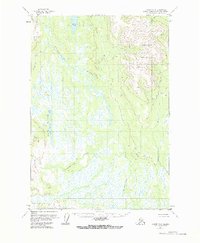
1954 Map of Tyonek C-4
USGS Topo · Published 1973About this map
Beluga Mountain dominates the northeast corner of this mid-century survey, its high ridges overlooking a vast network of wetlands and glacial waters. The Talachulitna River winds through the central valley, fed by tributaries like Texas Creek and Bear Creek. To the west, the landscape is defined by a dense concentration of lakes, including Hiline Lake, Movie Lake, and the elongated Trinity Lakes.
Find a feature on this map
15 named features on this map. Tap any name to fly to it.
Don’t see what you’re looking for? This feature index may not catch every label — zoom into the map to look around manually.
Map Details
Editions of this 1954 Tyonek C-4 Map
2 editions found
Other maps of this area

1949 · Tyonek
USGS Topo · 1:250,000

1951 · Tyonek
USGS Topo · 1:250,000

1954 · Tyonek D-3
USGS Topo · 1:63,360

1954 · Tyonek C-5
USGS Topo · 1:63,360

1954 · Tyonek C-4
USGS Topo · 1:63,360

1954 · Tyonek B-4
USGS Topo · 1:63,360

1954 · Tyonek D-5
USGS Topo · 1:63,360

1954 · Tyonek D-4
USGS Topo · 1:63,360

1954 · Tyonek C-3
USGS Topo · 1:63,360

1958 · Tyonek B-3
USGS Topo · 1:63,360