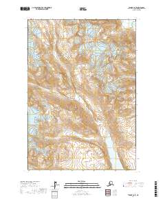
2017 Map of Tyonek C-6 SE
USGS Topo · Published 2017About this map
Strandline Lake dominates the southeastern quadrant of this terrain in the Matanuska-Susitna region, where the landscape is defined by massive glacial activity and high-elevation drainages. In the southwest, the edge of the Triumvirate Glacier marks a significant ice field, while the flow of the W Fork Coal Cr cuts through the eastern mountain slopes. This 2017 study illustrates the complex hydrological patterns of the area, showing the direct relationship between glacial margins and the formation of alpine lakes. The map provides a detailed record of the Public Land Survey System township and range lines, including t18n r15w and t17n r14w, which overlay this largely undeveloped wilderness area.
Find a feature on this map
9 named features on this map. Tap any name to fly to it.
Don’t see what you’re looking for? This feature index may not catch every label — zoom into the map to look around manually.
Map Details
Editions of this 2017 Tyonek C-6 SE Map
This is the sole edition of this map. No revisions or reprints were ever made.
Other maps of this area

1949 · Tyonek
USGS Topo · 1:250,000

1951 · Tyonek
USGS Topo · 1:250,000

1954 · Tyonek C-5
USGS Topo · 1:63,360

1958 · Tyonek C-6
USGS Topo · 1:63,360

1958 · Tyonek B-5
USGS Topo · 1:63,360

1958 · Tyonek B-6
USGS Topo · 1:63,360

1958 · Tyonek
USGS Topo · 1:250,000

1965 · Tyonek
USGS Topo · 1:250,000
2017 · Tyonek B-5 NW
USGS Topo · 1:25,000
2017 · Tyonek B-6 NE
USGS Topo · 1:25,000