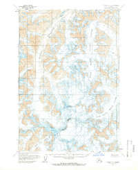
1958 Map of Tyonek C-7
USGS Topo · Published 1966About this map
Mount Gerdine dominates the center of this 1958 survey, marking the high point of a frozen landscape defined by massive ice fields and unrecorded mountain peaks. The map details the complex glacial geography at the intersection of the Matanuska-Susitna and Kenai Peninsula boundary, where no roads or established trails existed at the time of mapping. Extensive ice flows, including the Hayes Glacier and the North Branch Trimble Glacier, are depicted with intricate contour lines and crevasse markings. This topographic study, based on aerial photography from 1952 and 1957, captures a wilderness environment before significant modern climate shifts, providing a record of the South Branch Trimble Glacier, North Twin Glacier, and the curiously named Block and Tan Glacier.
Find a feature on this map
7 named features on this map. Tap any name to fly to it.
Don’t see what you’re looking for? This feature index may not catch every label — zoom into the map to look around manually.
Map Details
Editions of this 1958 Tyonek C-7 Map
This is the sole edition of this map. No revisions or reprints were ever made.
Other maps of this area

1949 · Tyonek
USGS Topo · 1:250,000

1951 · Tyonek
USGS Topo · 1:250,000

1958 · Tyonek C-6
USGS Topo · 1:63,360

1958 · Tyonek B-6
USGS Topo · 1:63,360

1958 · Tyonek D-6
USGS Topo · 1:63,360

1958 · Tyonek B-8
USGS Topo · 1:63,360

1958 · Tyonek C-8
USGS Topo · 1:63,360

1958 · Tyonek D-8
USGS Topo · 1:63,360

1958 · Tyonek
USGS Topo · 1:250,000
1958 · Tyonek B-7
USGS Topo · 1:63,360