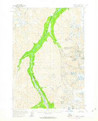
1958 Map of Tyonek C-8
USGS Topo · Published 1963About this map
The Skwentna River dominates this mid-century Alaskan landscape, its broad valley floor cutting a prominent path through the high mountains of the Matanuska-Susitna region. Based on aerial photography from the 1950s, the map illustrates a wilderness defined by glacial activity and drainage patterns rather than human settlement. The massive Black and Tan Glacier occupies the eastern portion of the sheet, while tributaries such as Emerald Creek and Crystal Creek feed into the central river system. At the time of this survey, the area remained largely unsurveyed on the ground, with land lines represented as predetermined locations by the Bureau of Land Management. This document captures the raw topography of the Alaska Range interior before modern infrastructure reached these high-elevation valleys.
Find a feature on this map
5 named features on this map. Tap any name to fly to it.
Don’t see what you’re looking for? This feature index may not catch every label — zoom into the map to look around manually.
Map Details
Editions of this 1958 Tyonek C-8 Map
2 editions found
Other maps of this area

1949 · Tyonek
USGS Topo · 1:250,000

1951 · Tyonek
USGS Topo · 1:250,000

1951 · Lime Hills
USGS Topo · 1:250,000

1958 · Tyonek B-8
USGS Topo · 1:63,360

1958 · Tyonek C-8
USGS Topo · 1:63,360

1958 · Tyonek D-8
USGS Topo · 1:63,360

1958 · Tyonek
USGS Topo · 1:250,000

1958 · Lime Hills B-1
USGS Topo · 1:63,360
1958 · Lime Hills D-1
USGS Topo · 1:63,360
1958 · Tyonek B-7
USGS Topo · 1:63,360