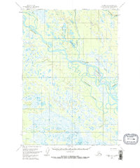
1954 Map of Tyonek D-3
USGS Topo · Published 1972About this map
The Yentna River meanders through this portion of south-central Alaska, creating a complex network of wetlands and braided channels as it nears its confluence with the Kahiltna River. This mid-century landscape is defined by its isolation, showing only the most vital markers of human presence. The map identifies the site of McDougal, noted as abandoned by the time of the 1950s survey, alongside scattered Cabin and Cabins locations that speak to a history of trapping or early bush commerce.
Find a feature on this map
17 named features on this map. Tap any name to fly to it.
Don’t see what you’re looking for? This feature index may not catch every label — zoom into the map to look around manually.
Map Details
Editions of this 1954 Tyonek D-3 Map
3 editions found
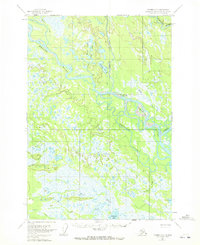
Other maps of this area

1949 · Tyonek
USGS Topo · 1:250,000

1950 · Talkeetna
USGS Topo · 1:250,000

1951 · Talkeetna
USGS Topo · 1:250,000

1951 · Tyonek
USGS Topo · 1:250,000

1954 · Tyonek D-2
USGS Topo · 1:63,360

1954 · Tyonek D-3
USGS Topo · 1:63,360

1954 · Talkeetna A-3
USGS Topo · 1:63,360

1954 · Tyonek C-4
USGS Topo · 1:63,360

1954 · Tyonek D-4
USGS Topo · 1:63,360

1954 · Talkeetna A-2
USGS Topo · 1:63,360