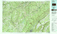
1984 Map of Tyrone
USGS Topo · Published 1985About this map
The ridge-and-valley landscape of Central Pennsylvania is dominated by the massive parallel formations of Bald Eagle Mountain, Tussey Mountain, and Brush Mountain in this 1984 topographical survey. The city of Altoona and the borough of Tyrone anchor the region's urban centers, which are connected by a heavy industrial corridor featuring the Conrail rail line and major routes like US Highway 220. This era captures the transition between traditional mountain industry and modern conservation, as evidenced by the vast stretches of Moshannon State Forest and recreational developments at Prince Gallitzin State Park surrounding Glendale Lake.
Find a feature on this map
200 named features on this map. Tap any name to fly to it.
Don’t see what you’re looking for? This feature index may not catch every label — zoom into the map to look around manually.
Map Details
Editions of this 1984 Tyrone Map
This is the sole edition of this map. No revisions or reprints were ever made.
Other maps of this area

1901 · Huntingdon
USGS Topo · 1:62,500

1902 · Indiana
USGS Topo · 1:62,500

1902 · Ebensburg
USGS Topo · 1:62,500

1902 · Patton
USGS Topo · 1:62,500

1902 · Barnesboro
USGS Topo · 1:62,500

1902 · Hollidaysburg
USGS Topo · 1:62,500

1903 · Curwensville
USGS Topo · 1:62,500

1903 · Hollidaysburg
USGS Topo · 1:62,500

1903 · Houtzdale
USGS Topo · 1:62,500

1904 · Huntingdon
USGS Topo · 1:62,500