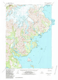
1951 Map of Ugashik A-2
USGS Topo · Published 1985About this map
The Alaska Peninsula National Wildlife Refuge dominates this coastal landscape, protecting a complex network of glacial valleys and deep marine inlets. The topography is defined by significant elevations like Icy Peak, where steep drainage systems feed into Kialagvik Creek and the Agripina River. Along the jagged shoreline, deep-water features such as Imuya Bay and Agripina Bay are punctuated by rocky hazards including Lone Rock and Cape Kilokak. This 1951 photogrammetric survey captures the uninhabited character of the region before modern administrative boundaries were finalized. In the southern waters, the map details the position of several remote landmasses within the Pacific Ocean, including David Island, Poltava I, and Ashiak I, providing a clear look at the navigational obstacles near Port Wrangell and Chiginagak Bay.
Find a feature on this map
15 named features on this map. Tap any name to fly to it.
Don’t see what you’re looking for? This feature index may not catch every label — zoom into the map to look around manually.
Map Details
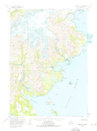
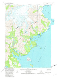
Editions of this 1951 Ugashik A-2 Map
4 editions found
Other maps of this area

1943 · Ugashik
USGS Topo · 1:250,000

1948 · Ugashik
USGS Topo · 1:250,000

1949 · Ugashik
USGS Topo · 1:250,000

1951 · Sutwik Island
USGS Topo · 1:250,000

1951 · Ugashik B-1
USGS Topo · 1:63,360

1951 · Ugashik B-3
USGS Topo · 1:63,360

1951 · Ugashik A-2
USGS Topo · 1:63,360

1951 · Ugashik B-2
USGS Topo · 1:63,360

1954 · Ugashik A-3
USGS Topo · 1:63,360

1954 · Sutwik Island D-3
USGS Topo · 1:63,360