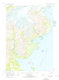
1951 Map of Ugashik A-2
USGS Topo · Published 1975About this map
Icy Peak stands as a prominent landmark in this mid-century coastal survey, overlooking a landscape defined by glacial activity and a complex shoreline along the Pacific Ocean. The terrain is marked by numerous crevasses and an unnamed Glacier that feeds toward Agripina Bay. This area of the Alaska Peninsula shows a wild, uninhabited expanse where the land meets the sea at dramatic points like Cape Kilokak and the sheltered waters of Port Wrangell.
Find a feature on this map
18 named features on this map. Tap any name to fly to it.
Don’t see what you’re looking for? This feature index may not catch every label — zoom into the map to look around manually.
Map Details
Editions of this 1951 Ugashik A-2 Map
4 editions found
Other maps of this area

1943 · Ugashik
USGS Topo · 1:250,000

1948 · Ugashik
USGS Topo · 1:250,000

1949 · Ugashik
USGS Topo · 1:250,000

1951 · Sutwik Island
USGS Topo · 1:250,000

1951 · Ugashik B-1
USGS Topo · 1:63,360

1951 · Ugashik B-3
USGS Topo · 1:63,360

1951 · Ugashik A-2
USGS Topo · 1:63,360

1951 · Ugashik B-2
USGS Topo · 1:63,360

1954 · Ugashik A-3
USGS Topo · 1:63,360

1954 · Sutwik Island D-3
USGS Topo · 1:63,360