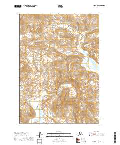
2019 Map of Ugashik A-3 SW
USGS Topo · Published 2019About this map
The Aleutian Range dominates this landscape in the Lake and Peninsula Borough of Alaska, represented here through high-resolution contour data from the National Elevation Dataset. This map covers a largely undeveloped portion of the Alaska Peninsula, where the terrain rises from glacial valleys toward prominent volcanic peaks. The lack of named settlements or man-made structures highlights the true wilderness character of the region. Instead, the sheet focuses on the complex hydrography and elevation changes across townships such as T35S R48W and T36S R47W. Researchers can study the fine-scale drainages and wetland patterns that define the hydrological network of this high-latitude environment.
Find a feature on this map
7 named features on this map. Tap any name to fly to it.
Don’t see what you’re looking for? This feature index may not catch every label — zoom into the map to look around manually.
Map Details
Editions of this 2019 Ugashik A-3 SW Map
This is the sole edition of this map. No revisions or reprints were ever made.
Other maps of this area

1943 · Ugashik
USGS Topo · 1:250,000

1948 · Ugashik
USGS Topo · 1:250,000

1949 · Ugashik
USGS Topo · 1:250,000

1951 · Sutwik Island
USGS Topo · 1:250,000

1954 · Ugashik A-3
USGS Topo · 1:63,360

1954 · Sutwik Island D-3
USGS Topo · 1:63,360

1963 · Ugashik A-4
USGS Topo · 1:63,360

1963 · Sutwik Island
USGS Topo · 1:250,000
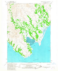
1963 · Sutwik Island D-4
USGS Topo · 1:63,360

1963 · Ugashik
USGS Topo · 1:250,000