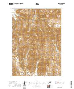
2019 Map of Ugashik A-4 SE
USGS Topo · Published 2019About this map
The Aleutian Range dominates this portion of the Alaska Peninsula, where steep topographic contours reveal a landscape defined by dramatic elevation changes. Flowing through the northern sections of the map, the waters of Indecision Cr cut through the high terrain, following a drainage pattern typical of this volcanic cordillera. This 2019 survey provides a precise view of the uninhabited backcountry within the Lake and Peninsula Borough, documenting the natural drainage and ridges before they reach the coastal lowlands. The map is primarily an inventory of the physical geography, illustrating the complex ridgelines and seasonal watercourses that characterize this wilderness area.
Find a feature on this map
8 named features on this map. Tap any name to fly to it.
Don’t see what you’re looking for? This feature index may not catch every label — zoom into the map to look around manually.
Map Details
Editions of this 2019 Ugashik A-4 SE Map
This is the sole edition of this map. No revisions or reprints were ever made.
Other maps of this area

1943 · Ugashik
USGS Topo · 1:250,000

1948 · Ugashik
USGS Topo · 1:250,000

1949 · Ugashik
USGS Topo · 1:250,000

1951 · Sutwik Island
USGS Topo · 1:250,000

1954 · Ugashik A-3
USGS Topo · 1:63,360

1954 · Sutwik Island D-3
USGS Topo · 1:63,360

1963 · Ugashik A-4
USGS Topo · 1:63,360

1963 · Sutwik Island
USGS Topo · 1:250,000
1963 · Sutwik Island D-4
USGS Topo · 1:63,360

1963 · Ugashik
USGS Topo · 1:250,000