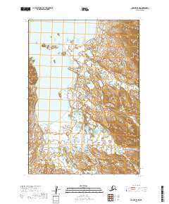
2019 Map of Ugashik B-3 NE
USGS Topo · Published 2019About this map
Lower Ugashik Lake dominates the western portion of this terrain, where its irregular shoreline meets a network of wetlands and low-lying coastal plains. This landscape in the Lake and Peninsula Borough is defined by a heavy hydraulic presence, with Black Cr winding through the eastern highlands before descending toward the basin. The map reveals a transition from the structured township lines of the t31s r46w and t32s r46w sections to the varied topography of the Aleutian Range foothills. This 2019 survey documents a largely undeveloped wilderness where drainage patterns and elevation contours are the primary identifiers, illustrating the remote character of the Alaska Peninsula. Researchers can trace the specific watercourse of Black Cr as it meanders through the glacial-carved valleys of the eastern boundary.
Find a feature on this map
6 named features on this map. Tap any name to fly to it.
Don’t see what you’re looking for? This feature index may not catch every label — zoom into the map to look around manually.
Map Details
Editions of this 2019 Ugashik B-3 NE Map
This is the sole edition of this map. No revisions or reprints were ever made.
Other maps of this area

1943 · Ugashik
USGS Topo · 1:250,000

1948 · Ugashik
USGS Topo · 1:250,000

1949 · Ugashik
USGS Topo · 1:250,000

1951 · Ugashik B-3
USGS Topo · 1:63,360

1951 · Ugashik C-2
USGS Topo · 1:63,360

1951 · Ugashik C-3
USGS Topo · 1:63,360

1951 · Ugashik B-2
USGS Topo · 1:63,360

1963 · Ugashik
USGS Topo · 1:250,000
2019 · Ugashik B-2 SW
USGS Topo · 1:25,000
2019 · Ugashik B-3 SW
USGS Topo · 1:25,000