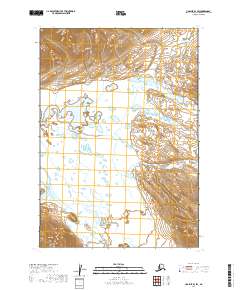
2019 Map of Ugashik B-3 SW
USGS Topo · Published 2019About this map
The Aleutian Range forms a dramatic backdrop for this remote Alaskan landscape, where glacial meltwater and seasonal runoff carve a complex network of waterways. The Dog Salmon River meanders across the southwestern corner, joined by the aptly named Wandering Creek. This area is characterized by low-lying wetlands and intricate drainage patterns typical of the Alaska Peninsula. Significant water bodies such as Goblet Cr and Figure Eight Cr illustrate the dynamic nature of the terrain, where shifting channels and numerous small ponds dominate the topography. The map detail provides an essential look at this unpopulated wilderness, capturing the untouched hydrography of the region's diverse ecosystems.
Find a feature on this map
12 named features on this map. Tap any name to fly to it.
Don’t see what you’re looking for? This feature index may not catch every label — zoom into the map to look around manually.
Map Details
Editions of this 2019 Ugashik B-3 SW Map
This is the sole edition of this map. No revisions or reprints were ever made.
Other maps of this area

1943 · Ugashik
USGS Topo · 1:250,000

1948 · Ugashik
USGS Topo · 1:250,000

1949 · Ugashik
USGS Topo · 1:250,000

1951 · Ugashik B-3
USGS Topo · 1:63,360

1954 · Ugashik A-3
USGS Topo · 1:63,360

1954 · Ugashik B-4
USGS Topo · 1:63,360

1963 · Ugashik A-4
USGS Topo · 1:63,360

1963 · Ugashik
USGS Topo · 1:250,000
2019 · Ugashik B-4 SE
USGS Topo · 1:25,000
2019 · Ugashik A-3 NE
USGS Topo · 1:25,000