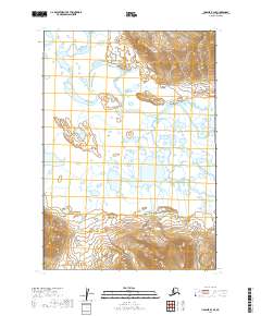
2019 Map of Ugashik B-4 SE
USGS Topo · Published 2019About this map
The Dog Salmon River meanders across a landscape defined by water and high relief in this remote section of the Aleutian Range. This 2019 survey documents a complex network of wetlands and oxbow lakes formed by the shifting course of the river, which dominates the central and northern portions of the quadrangle. As the river flows through these low-lying reaches, it is fed by smaller tributaries like Wandering Creek, which winds through the southern terrain. This map serves as a primary record of the hydrological patterns and topographic contours of the Alaska Peninsula, illustrating the transition from steep mountain slopes to the saturated river basins. The lack of roads or established settlements emphasizes the wilderness character of the Lake and Peninsula Borough, where the natural drainage of the Dog Salmon River remains the primary geographical feature.
Find a feature on this map
9 named features on this map. Tap any name to fly to it.
Don’t see what you’re looking for? This feature index may not catch every label — zoom into the map to look around manually.
Map Details
Editions of this 2019 Ugashik B-4 SE Map
This is the sole edition of this map. No revisions or reprints were ever made.
Other maps of this area

1943 · Ugashik
USGS Topo · 1:250,000

1948 · Ugashik
USGS Topo · 1:250,000

1949 · Ugashik
USGS Topo · 1:250,000

1951 · Ugashik B-3
USGS Topo · 1:63,360

1954 · Ugashik A-3
USGS Topo · 1:63,360

1954 · Ugashik B-4
USGS Topo · 1:63,360

1963 · Ugashik A-4
USGS Topo · 1:63,360

1963 · Ugashik
USGS Topo · 1:250,000
2019 · Ugashik B-3 SW
USGS Topo · 1:25,000
2019 · Ugashik A-3 NW
USGS Topo · 1:25,000