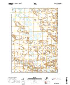
2019 Map of Ugashik B-5 SW
USGS Topo · Published 2019About this map
King Salmon River meanders across the southern reach of this landscape, its complex oxbows and channels characterizing a wilderness region within the Lake and Peninsula Borough. The terrain is defined by an extensive network of wetlands and small lakes that dominate the northern and central sections, suggesting a low-lying, water-saturated environment. Surveyed under the Public Land Survey System, the map delineates various townships including t32s r52w and t34s r51w. The absence of roads, buildings, or named settlements highlights the area's role as a remote ecological corridor where natural water systems remain the primary geographic features.
Find a feature on this map
7 named features on this map. Tap any name to fly to it.
Don’t see what you’re looking for? This feature index may not catch every label — zoom into the map to look around manually.
Map Details
Editions of this 2019 Ugashik B-5 SW Map
This is the sole edition of this map. No revisions or reprints were ever made.
Other maps of this area

1943 · Ugashik
USGS Topo · 1:250,000

1948 · Ugashik
USGS Topo · 1:250,000

1949 · Ugashik
USGS Topo · 1:250,000

1954 · Ugashik B-5
USGS Topo · 1:63,360

1963 · Ugashik B-6
USGS Topo · 1:63,360

1963 · Ugashik A-6
USGS Topo · 1:63,360
1963 · Ugashik A-5
USGS Topo · 1:63,360

1963 · Ugashik
USGS Topo · 1:250,000
2019 · Ugashik A-6 NE
USGS Topo · 1:25,000
2019 · Ugashik A-5 NE
USGS Topo · 1:25,000