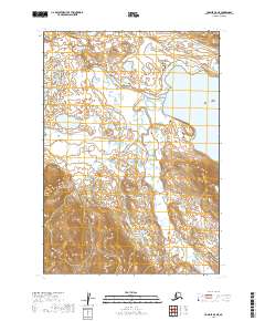
2019 Map of Ugashik A-5 NE
USGS Topo · Published 2019About this map
The Alaska Peninsula landscape in the Lake and Peninsula Borough is defined by a vast network of water and dramatic topographic shifts. The King Salmon River meanders across the northern sections of the map, carving through low-lying terrain before the land rises sharply toward the south. To the east, the substantial waters of Mother Goose Lake dominate the valley floor, fed and drained by the branching system of Painter Creek. This 2019 survey captures a wild environment where seasonal drainage patterns are clear, with the smaller Painter Cr navigating the steep southern ridges. The lack of roads or established settlements emphasizes the dominance of the river systems in this part of the peninsula.
Find a feature on this map
9 named features on this map. Tap any name to fly to it.
Don’t see what you’re looking for? This feature index may not catch every label — zoom into the map to look around manually.
Map Details
Editions of this 2019 Ugashik A-5 NE Map
This is the sole edition of this map. No revisions or reprints were ever made.
Other maps of this area

1943 · Ugashik
USGS Topo · 1:250,000

1948 · Ugashik
USGS Topo · 1:250,000

1949 · Ugashik
USGS Topo · 1:250,000

1954 · Ugashik B-4
USGS Topo · 1:63,360

1954 · Ugashik B-5
USGS Topo · 1:63,360

1963 · Ugashik A-4
USGS Topo · 1:63,360
1963 · Ugashik A-5
USGS Topo · 1:63,360

1963 · Ugashik
USGS Topo · 1:250,000
2019 · Ugashik B-5 SW
USGS Topo · 1:25,000
2019 · Ugashik A-5 NW
USGS Topo · 1:25,000