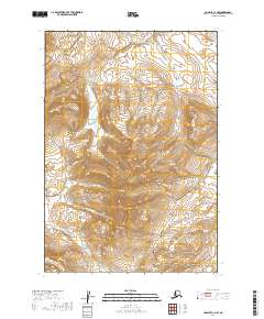
2019 Map of Ugashik C-1 NW
USGS Topo · Published 2019About this map
The Aleutian Range dominates this portion of the Alaska Peninsula, where steep summits and high-altitude passes dictate the drainage patterns of the local watershed. Significant peaks including Mt Simeon, Mt Burls, Mt Lee, and Mt Demian form a formidable barrier, intersected only by remote crossings like Featherly Pass, Simeon Pass, and Burls Pass.
Find a feature on this map
23 named features on this map. Tap any name to fly to it.
Don’t see what you’re looking for? This feature index may not catch every label — zoom into the map to look around manually.
Map Details
Editions of this 2019 Ugashik C-1 NW Map
This is the sole edition of this map. No revisions or reprints were ever made.
Other maps of this area

1943 · Ugashik
USGS Topo · 1:250,000

1948 · Ugashik
USGS Topo · 1:250,000

1949 · Ugashik
USGS Topo · 1:250,000

1951 · Ugashik D-1
USGS Topo · 1:63,360

1951 · Ugashik C-1
USGS Topo · 1:63,360

1951 · Ugashik C-2
USGS Topo · 1:63,360

1951 · Ugashik D-2
USGS Topo · 1:63,360

1963 · Ugashik
USGS Topo · 1:250,000
2019 · Ugashik C-2 SE
USGS Topo · 1:25,000
2019 · Ugashik D-1 SE
USGS Topo · 1:25,000